 |
This is a file from the Wikimedia Commons. Information from its description page there is shown below.
Commons is a freely licensed media file repository. You can help.
|
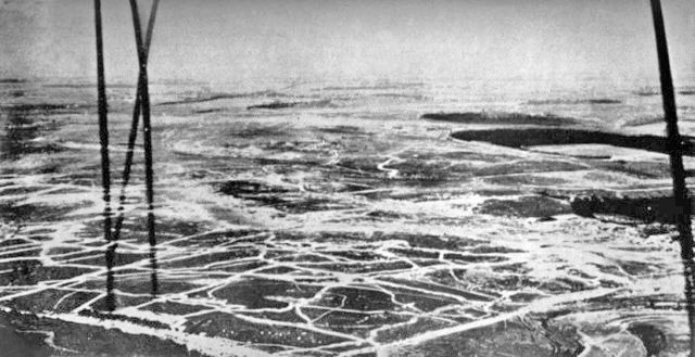
Photo of the Somme battlefield taken from a British observation kite-balloon, July 1916. The balloon is tethered near Bécourt, between La Boisselle and Fricourt, and the view is northeast towards Bapaume. The dark areas on the right of the photo are, from bottom to top, the woods of Fricourt, Mametz and Bazentin. The British front line is at the bottom foreground. The German front line is the blurred line across the centre of the photo, having been subjected to the prolonged British artillery bombardment. The Roman road from Albert to Bapaume is just visible running diagonally across the top-left of the photo.
Published in the Official History of Australia in the War of 1914-1918: Vol. III, C.E.W. Bean, 1929
Credit: British Air Force Photograph
| Public domainPublic domainfalsefalse |
 |
This artistic work created by the United Kingdom Government is in the public domain. This is because it is one of the following:
- It is a photograph created by the United Kingdom Government and taken prior to 1 June 1957; or
- It was commercially published prior to 1963; or
- It is an artistic work other than a photograph or engraving (e.g. a painting) which was created by the United Kingdom Government prior to 1963.
HMSO has declared that the expiry of Crown Copyrights applies worldwide (ref: HMSO Email Reply)
More information.
See also Copyright and Crown copyright artistic works.
|
|
File usage
The following pages on Schools Wikipedia link to this image (list may be incomplete):
This file contains additional information, probably added from the digital camera or scanner used to create or digitize it. If the file has been modified from its original state, some details may not fully reflect the modified file.


