Checked content

File:Scotland from the Matthew Paris map, c.1250.jpg

Scotland_from_the_Matthew_Paris_map,_c.1250.jpg(522 × 399 pixels, file size: 103 KB, MIME type: image/jpeg)

Contents

Summary

Description
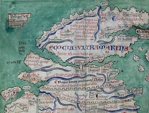
English: Scotland Beyond The Sea: a detail from the Matthew Paris map of Britain, c.1250
The Scottish heartland (Alba) is perceived as almost a separate island above the Rivers Forth and Clyde, reached by Stirling Bridge. Mediaeval English chroniclers refer to the Firth of Forth as 'the Scottish Sea' (This image is annotated on its description page).
Date 30 August 2011
Source British Library
Author

Licensing

Public domain This work is in the public domain in the United States, and those countries with a copyright term of life of the author plus 100 years or less.
This file has been identified as being free of known restrictions under copyright law, including all related and neighboring rights.


Annotations This image is annotated: View the annotations at Commons

File usage on other wikis

Related galleries

The following pages on Schools Wikipedia link to this image (list may be incomplete):

Background information

Wikipedia for Schools is designed to make learning fun and easy. The world's largest orphan charity, SOS Childrens Villages brings a better life to more than 2 million people in 133 countries around the globe. You can help by sponsoring a child.