Checked content

File:Westernsaharamap.png
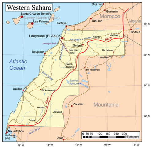
This is a general map of Western Sahara based primarily on the Digital Chart of the World, with this UN map and commercial atlases (Rand McNally, Google, Encarta, and National Geographic) used as references. An unlabeled version of this map is at Image:Westernsaharamapunlabeled.png.

The Polisario Front controls the area to the east of the berm, while Morocco controls the area to the west.

I, the copyright holder of this work, hereby publish it under the following license:
w:en:Creative Commons
attribution share alike
This file is licensed under the Creative Commons Attribution-Share Alike 2.5 Generic license.
You are free:
  • to share – to copy, distribute and transmit the work
  • to remix – to adapt the work
Under the following conditions:
  • attribution – You must attribute the work in the manner specified by the author or licensor (but not in any way that suggests that they endorse you or your use of the work).
  • share alike – If you alter, transform, or build upon this work, you may distribute the resulting work only under the same or similar license to this one.

The following pages on Schools Wikipedia link to this image (list may be incomplete):

Want to know more?

Schools Wikipedia was created by children's charity SOS Children. SOS Children cares for children who have lost their parents. Our Children's Villages give these children a new home and a new family, while a high-quality education and the best of medical care ensures they will grow up with all they need to succeed in adult life. Sponsoring a child is the coolest way to help.