 |
This is a file from the Wikimedia Commons. Information from its description page there is shown below.
Commons is a freely licensed media file repository. You can help.
|
Summary
| Description |
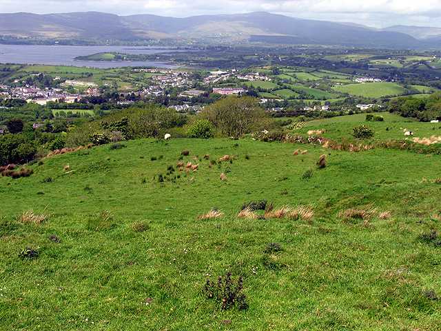
English: Pasture at the Viewpoint. This field in the foreground is at the viewpoint marked on the map. The town of Bantry is visible in the distance, in the valley. The harbour and town centre is to the far left of the built up area.
|
| Date |
28 May 2005 |
| Source |
From geograph.org.uk |
| Author |
Pam Brophy |
|
Camera location
|
51° 39′ 45.04″ N, 9° 26′ 20.61″ W
|
This and other images at their locations on: Google Maps - Google Earth - OpenStreetMap |
( Info)51.662511;-9.439058 |
Licensing
 |
This image was taken from the Geograph project collection. See this photograph's page on the Geograph website for the photographer's contact details. The copyright on this image is owned by Pam Brophy and is licensed for reuse under the Creative Commons Attribution-ShareAlike 2.0 license. |
 The categories of this image should be checked. Check them now!
- Remove redundant categories and try to put this image in the most specific category/categories
- Remove this template
- The location categories are based on information from this geonames tool and this OpenStreetMap tool combined with a database. You can also have a look at this tool from mysociety.
- The topic category from Geograph was Pasture (find similar images at Geograph)
This image was uploaded as part of the Geograph batch upload
File usage
The following pages on Schools Wikipedia link to this image (list may be incomplete):
SOS Childrens Villages has brought Wikipedia to the classroom. SOS Children believes that a decent childhood is essential to a happy, healthy. Our community work brings families new opportunities through education, healthcare and all manner of support. Would you like to sponsor a child?


