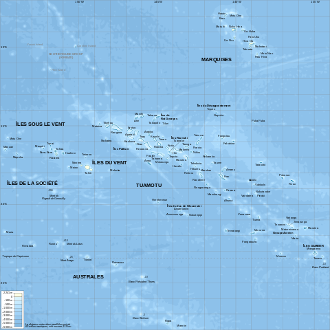
File:French Polynesia relief map.svg

| |
This is a file from the Wikimedia Commons. Information from its description page there is shown below.
Commons is a freely licensed media file repository. You can help. |
Summary
| DescriptionFrench Polynesia relief map.svg |
English: Topographic map with French names of French Polynesia
Français : Carte topographique de la Polynésie française, en français
|
| Date | October 2008 |
| Source | Own work. Data sources :
Softwares used :
Others :
|
| Author | L. Claudel ( Sardon - fr:Sardon) |
This map was improved or created by the Wikigraphists of the Graphic Lab (fr). You can propose images to clean up, improve, create or translate as well.
বাংলা | català | česky | Deutsch | Deutsch (Sie-Form) | Ελληνικά | English | Esperanto | español | suomi | français | עברית | magyar | Հայերեն | italiano | 한국어 | македонски | Bahasa Melayu | Plattdüütsch | Nederlands | occitan | polski | português | română | русский | slovenščina | svenska | татарча/tatarça | Türkçe | українська | 中文 | 中文(简体) | 中文(繁體) | Zazaki | +/−
| |
This SVG file uses embedded text that can be easily translated into your language using this automated tool. Learn more. You can also download it and translate it manually using a text editor.
|
|
|
This vector image was created with Inkscape. |
Licensing
|
File usage
Metadata
| Width | 1260 |
|---|---|
| Height | 1260 |
Want to know more?
All five editions of Schools Wikipedia were compiled by SOS Children. SOS Childrens Villages is there for the children in our care until they are ready for independence. Have you heard about child sponsorship? Learn more...

