
File:Map of Christmas Island 1976.jpg
Size of this preview: 525 × 479 pixels.
| |
This is a file from the Wikimedia Commons. Information from its description page there is shown below.
Commons is a freely licensed media file repository. You can help. |
Summary
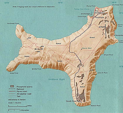
Map of Christmas. This map was produced by the U.S. Central Intelligence Agency, unless otherwise indicated. Maps dated 1976 were taken from The Indian Ocean Atlas, published by the Central Intelligence Agency. Link to source: http://www.lib.utexas.edu/maps/islands_oceans_poles/christmas_island_76.jpg
Licensing
 |
This image is a work of a Central Intelligence Agency employee, taken or made as part of that person's official duties. As a Work of the United States Government, this image or media is in the public domain.
|
 |
File usage
The following pages on Schools Wikipedia link to this image (list may be incomplete):
Learn more about Schools Wikipedia
SOS Childrens Villages aims to make Wikipedia suitable for young learners. The world's largest orphan charity, SOS Children brings a better life to more than 2 million people in 133 countries around the globe. Have you thought about sponsoring a child?