
File:GuineaMap.png
GuineaMap.png (330 × 355 pixels, file size: 11 KB, MIME type: image/png)
| |
This is a file from the Wikimedia Commons. Information from its description page there is shown below.
Commons is a freely licensed media file repository. You can help. |
Summary
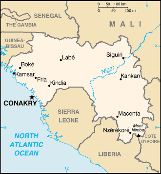
| Description |
Map of Guinea, U.S. Central Intelligence Agency World Factbook map, 2002. |
||
| Date | 2002 | ||
| Source | University of Texas Libraries, Perry-Castañeda Library Map Collection: CIA World Factbook 2002 - Country Maps
|
||
| Author | CIA |
Licensing
 |
This image is a work of a Central Intelligence Agency employee, taken or made as part of that person's official duties. As a Work of the United States Government, this image or media is in the public domain.
|
 |
File usage
The following pages on Schools Wikipedia link to this image (list may be incomplete):
About Schools Wikipedia
All five editions of Schools Wikipedia were compiled by SOS Children. SOS Childrens Villages believes that a decent childhood is essential to a happy, healthy. Our community work brings families new opportunities through education, healthcare and all manner of support. Learn more about child sponsorship.