
File:Kenya-relief-map-towns.jpg
Size of this preview: 405 × 479 pixels.
| |
This is a file from the Wikimedia Commons. Information from its description page there is shown below.
Commons is a freely licensed media file repository. You can help. |
Summary
| Description |
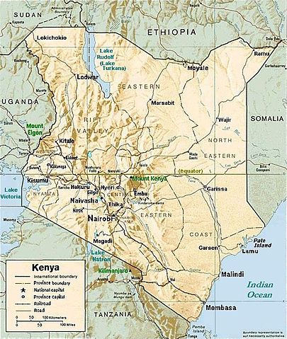
English: Kenya relief map with town names for Nairobi, Mombasa, Naivasha, Nakuru, Nyeri, Gilgil, Kisumu, Kakamega, Eldoret, Embu, etc.
|
| Date | |
| Source | Town names enlarged on Image:Kenya Map.png |
| Author | CIA, modified by Mehmet Karatay |
 |
This map image could be recreated using vector graphics as an SVG file. This has several advantages; see Commons:Media for cleanup for more information. If an SVG form of this image is already available, please upload it. After uploading an SVG, replace this template with {{ vector version available|new image name.svg}}. |
Licensing
 |
This image is a work of a Central Intelligence Agency employee, taken or made as part of that person's official duties. As a Work of the United States Government, this image or media is in the public domain.
|
 |
File usage
The following pages on Schools Wikipedia link to this image (list may be incomplete):
Find out about Schools Wikipedia
Schools Wikipedia was created by children's charity SOS Children. More than 2 million people benefit from the global charity work of SOS Children, and our work in 133 countries around the world is vital to ensuring a better future for vulnerable children. Will you help another child today?