
File:Uganda Topography.png
Size of this preview: 493 × 480 pixels.
| |
This is a file from the Wikimedia Commons. Information from its description page there is shown below.
Commons is a freely licensed media file repository. You can help. |
Summary
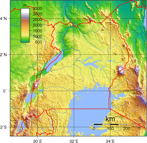
| Description | Topographic map of Uganda. Created with GMT from SRTM data. |
| Date | 2 June 2007 |
| Source | Own work |
| Author | Sadalmelik |
Licensing
 |
This work has been released into the public domain by its author, I, Sadalmelik. This applies worldwide. In some countries this may not be legally possible; if so: I, Sadalmelik grants anyone the right to use this work for any purpose, without any conditions, unless such conditions are required by law.
|
File usage
The following pages on Schools Wikipedia link to this image (list may be incomplete):
Wikipedia for Schools...
SOS Children aims to make Wikipedia suitable for young learners. SOS Children is there for the children in our care until they are ready for independence. Would you like to sponsor a child?