
File:Equatorial Guinea Map.png
Size of this preview: 387 × 480 pixels.
| |
This is a file from the Wikimedia Commons. Information from its description page there is shown below.
Commons is a freely licensed media file repository. You can help. |
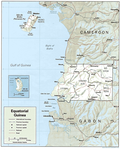
| Description | Shaded relief map of Equatorial Guinea. | |||
| Date | 1992 | |||
| Source | from the Perry-Castañeda Library Map Collection. | |||
| Author | CIA | |||
| Permission ( Reusing this file) |
|


File usage
The following pages on Schools Wikipedia link to this image (list may be incomplete):
Did you know...?
You can learn about nearly 6,000 different topics on Schools Wikipedia. In 133 nations around the world, SOS Children's Villages works to bring better education and healthcare to families in desperate need of support. Have you thought about sponsoring a child?