
File:Walvis Bay map.jpeg
Walvis_Bay_map.jpeg (372 × 420 pixels, file size: 34 KB, MIME type: image/jpeg)
| |
This is a file from the Wikimedia Commons. Information from its description page there is shown below.
Commons is a freely licensed media file repository. You can help. |
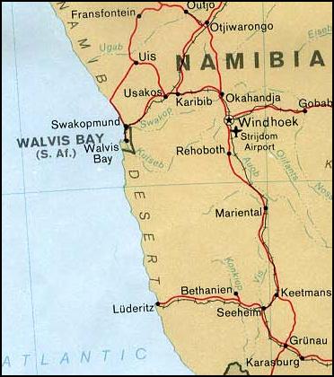
Summary
| Description | Map of Walvis Bay (Namibia) | |||
| Date | 1978 | |||
| Source | From the University of Texas PCL Map Collection | |||
| Author | U.S. Central Intelligence Agency | |||
| Permission ( Reusing this file) |
|


File usage
The following pages on Schools Wikipedia link to this image (list may be incomplete):
The best way to learn
Schools Wikipedia was launched to make learning available to everyone. SOS Children's Villages helps those who have nothing and no one, giving them back the famly they have lost and bringing them the very best opportunities for a happy, healthy future. Sponsoring a child is a great way to help children who need your support.