 |
This is a file from the Wikimedia Commons. Information from its description page there is shown below.
Commons is a freely licensed media file repository. You can help.
|
| Description |
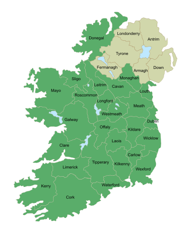
Česky: Mapa irských hrabství se jmény, hrabství Severního Irska jsou vybarveny okrově
English: Map of Ireland's counties with names, Northern Ireland counties colored tan
|
| Date |
2009-11-23 07:27 (UTC) |
| Source |
|
| Author |
- derivative work: The Illusional Ministry ( talk)
- derivative work: Sswonk ( talk)
|
 ✓ The source code of this SVG is valid.
File usage
The following pages on Schools Wikipedia link to this image (list may be incomplete):
This file contains additional information, probably added from the digital camera or scanner used to create or digitize it. If the file has been modified from its original state, some details may not fully reflect the modified file.
SOS Childrens Villages has brought Wikipedia to the classroom. SOS Childrens Villages believes that a decent childhood is essential to a happy, healthy. Our community work brings families new opportunities through education, healthcare and all manner of support. Find out more about sponsoring a child.


