 |
This is a file from the Wikimedia Commons. Information from its description page there is shown below.
Commons is a freely licensed media file repository. You can help.
|
Summary
| Description |
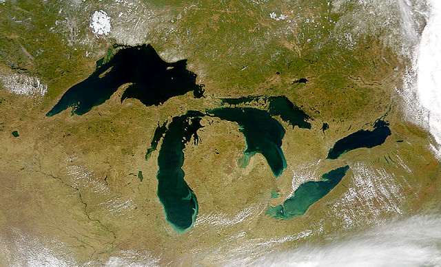
Satellite image of the Great Lakes from space |
| Date |
24 April 2000 |
| Source |
http://visibleearth.nasa.gov/view_rec.php?id=793 |
| Author |
SeaWiFS Project, NASA/Goddard Space Flight Centre, and ORBIMAGE. |
Licensing
| Public domainPublic domainfalsefalse |
 |
This image is from the Sea-viewing Wide Field-of-view Sensor ( SeaWiFS) Project and more than 5 years old. Satellite data captured by the SeaWIFS sensor are released into the public domain 5 years after capture. Data less than five years old can be re-used only for educational or scientific purposes; any commercial use of such images must be coordinated with GeoEye.
|
File usage
The following pages on Schools Wikipedia link to this image (list may be incomplete):
SOS Children's Villages chose the best bits of Wikipedia to help you learn. SOS Childrens Villages helps those who have nothing and no one, giving them back the famly they have lost and bringing them the very best opportunities for a happy, healthy future. There are many ways to help with SOS Childrens Villages.


