 |
This is a file from the Wikimedia Commons. Information from its description page there is shown below.
Commons is a freely licensed media file repository. You can help.
|
Summary
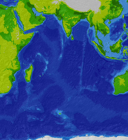
Topographic/bathymetric map of the Indian Ocean region.
Source data: SRTM30_plus 30 arc-second satellite elevation data.
Projection: Winkel I, central median E 80 deg. WGS84 datum.
Projected and hillshaded using ESRI ArcGIS 9.0. Uploaded by the creator.
Licensing
 |
Permission is granted to copy, distribute and/or modify this document under the terms of the GNU Free Documentation License, Version 1.2 or any later version published by the Free Software Foundation; with no Invariant Sections, no Front-Cover Texts, and no Back-Cover Texts. A copy of the license is included in the section entitled GNU Free Documentation License. http://www.gnu.org/copyleft/fdl.htmlGFDLGNU Free Documentation Licensetruetrue
|
File usage
The following pages on Schools Wikipedia link to this image (list may be incomplete):
SOS Childrens Villages has brought Wikipedia to the classroom. By supporting vulnerable children right through to adulthood, SOS Children makes a lasting difference to the lives of thousands of people. Education is a key part of our work, and our schools provide high-quality teaching to the children in our care. There are many ways to help with SOS Children's Villages.


