
File:Milecastle 39 on Hadrian's Wall.jpg
Size of this preview: 640 × 427 pixels.
| |
This is a file from the Wikimedia Commons. Information from its description page there is shown below.
Commons is a freely licensed media file repository. You can help. |
Summary
| Description |
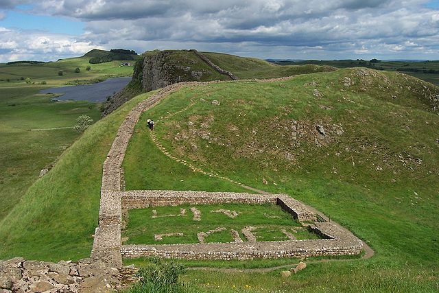
English: The remains of Milecastle 39 (coordinates 55° 0' 13.12" N, 2° 22' 32.74" W) on Hadrian's Wall; near Steel Rigg, looking east from a ridge along the Hadrian's Wall Path. Milecastle 39 is also known as Castle Nick.
Svenska: Ruinerna efter Milecastle 39 (koordinater 55° 0' 13.12" N, 2° 22' 32.74" V), beläget nära Steel Rigg utmed Hadrianus mur. Fortifikationen – som också kallas Castle Nick – vätter mot öster och är byggd på en ås längs vandringsleden Hadrian's Wall Path.
|
||
| Date | June 2007 | ||
| Source | Photograph by uploader | ||
| Author | Adam Cuerden | ||
| Permission ( Reusing this file) |
|

File usage
The following pages on Schools Wikipedia link to this image (list may be incomplete):
Metadata
Schools Wikipedia facts
SOS Children chose the best bits of Wikipedia to help you learn. Our 500 Children's Villages provide a home for thousands of vulnerable children. Beyond our Villages, we support communities, helping local people establish better schools and delivering effective medical care to vulnerable children. We have helped children in Africa for many years - you can help too...