
File:Straits of Malacca.png
- File
- File usage
- The best way to learn
Size of this preview: 486 × 479 pixels.
| |
This is a file from the Wikimedia Commons. Information from its description page there is shown below.
Commons is a freely licensed media file repository. You can help. |
| |
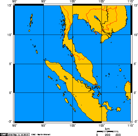
The map has been created with the Generic Mapping Tools: http://gmt.soest.hawaii.edu/ using one or more of these public domain datasets for the relief:
|
 |
Permission is granted to copy, distribute and/or modify this document under the terms of the GNU Free Documentation License, Version 1.2 or any later version published by the Free Software Foundation; with no Invariant Sections, no Front-Cover Texts, and no Back-Cover Texts. A copy of the license is included in the section entitled GNU Free Documentation License.
|
| This file is licensed under the Creative Commons Attribution-Share Alike 3.0 Unported license. | ||
|
||
| This licensing tag was added to this file as part of the GFDL licensing update.
|
-
Suomi: Malakan salmi
-
English: Strait of Malacca
The best way to learn
SOS Children has brought Wikipedia to the classroom. SOS Childrens Villages helps more than 2 million people across 133 countries around the world. Find out how you can help children in other countries.