
File:LocationMauritius.png
LocationMauritius.png (248 × 117 pixels, file size: 3 KB, MIME type: image/png)
| |
This is a file from the Wikimedia Commons. Information from its description page there is shown below.
Commons is a freely licensed media file repository. You can help. |
 |
This map image could be recreated using vector graphics as an SVG file. This has several advantages; see Commons:Media for cleanup for more information. If an SVG form of this image is already available, please upload it. After uploading an SVG, replace this template with {{ vector version available|new image name.svg}}. |
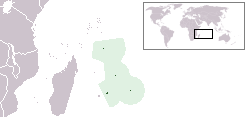
Location map for the Mauritius.
Originally created for English Wikipedia by Vardion.
 |
This work has been released into the public domain by its author, Vardion at the English Wikipedia project. This applies worldwide. In case this is not legally possible: |
File usage
The following pages on Schools Wikipedia link to this image (list may be incomplete):
More information
Schools Wikipedia has been carefully checked to give you the best learning experience. SOS Childrens Villages helps more than 2 million people across 133 countries around the world. Find out how you can help children in other countries.