 |
This is a file from the Wikimedia Commons. Information from its description page there is shown below.
Commons is a freely licensed media file repository. You can help.
|
| Description |
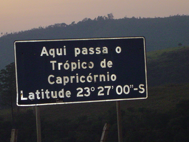
Trópico de Capricórnio. Linha imaginária que passa pelo Estado de São Paulo. Esta foto mostra o ponto de passagem no município de Santana de Parnaíba. WARNING: This was true for 1917; the Tropic is presently (Epoch 2011) at 23º 26' 16" - See Useful constants |
| Date |
28 May 2007 |
| Source |
Own work |
| Author |
( HTPF) |
Permission
( Reusing this file) |
| Public domainPublic domainfalsefalse |
 |
I, the copyright holder of this work, release this work into the public domain. This applies worldwide.
In some countries this may not be legally possible; if so:
I grant anyone the right to use this work for any purpose, without any conditions, unless such conditions are required by law.Public domainPublic domainfalsefalse
|
|
File usage
The following pages on Schools Wikipedia link to this image (list may be incomplete):
This file contains additional information, probably added from the digital camera or scanner used to create or digitize it. If the file has been modified from its original state, some details may not fully reflect the modified file.
Wikipedia for Schools was collected by SOS Children's Villages. SOS Children's Villages works in 133 countries and territories across the globe, helps more than 62,000 children, and reaches over 2 million people in total. Would you like to sponsor a child?


