 |
This is a file from the Wikimedia Commons. Information from its description page there is shown below.
Commons is a freely licensed media file repository. You can help.
|
| Description |
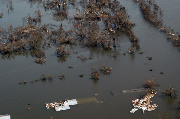
Flooding in Venice, Louisiana after Hurricane Katrina. Part of Venice, LA, on August 30, 2005. The southernmost permanently inhabited area on the Louisiana coast, Venice is located within a ring levee on the Mississippi River. The levee was ineffective during Hurricane Katrina. The entire town was flooded, oil-field vessels and barges were strewn haphazardly, and huge deposits of wrack were left on both sides of the ring levee on the west side of town. |
| Date |
30 August 2005 |
| Source |
http://soundwaves.usgs.gov/2005/09/ |
| Author |
User Storm05 on en.wikipedia |
Permission
( Reusing this file) |
| Public domainPublic domainfalsefalse |
 |
This image is in the public domain because it contains materials that originally came from the United States Geological Survey, an agency of the United States Department of the Interior. For more information, see the official USGS copyright policy.
български | català | Deutsch | English | español | eesti | suomi | français | galego | italiano | 한국어 | македонски | മലയാളം | Nederlands | polski | português | русский | Türkçe | 中文 | 中文(简体) | +/−
|
|
|
File usage
The following pages on Schools Wikipedia link to this image (list may be incomplete):
Schools Wikipedia was launched to make learning available to everyone. Our 500 Children's Villages provide a home for thousands of vulnerable children. Beyond our Villages, we support communities, helping local people establish better schools and delivering effective medical care to vulnerable children. Want to learn more? Go to http://www.soschildrensvillages.org.uk/sponsor-a-child


