
File:Map of Iceland.svg
Size of this preview: 591 × 480 pixels.
| |
This is a file from the Wikimedia Commons. Information from its description page there is shown below.
Commons is a freely licensed media file repository. You can help. |
Summary
| Description |
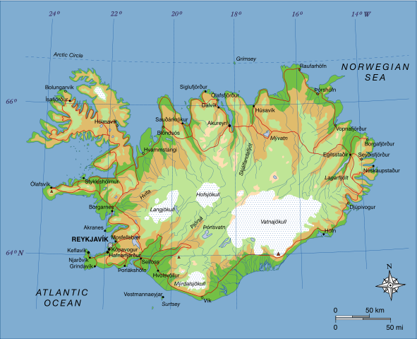
A map of Iceland, showing major towns, rivers, lakes and glaciers. Translated from a map on the Greek Wikipedia ( located here). |
| Date | 23 June 2007 |
| Source | Own work, based on File:Map of Iceland el.svg created by el:user:Αντιγόνη |
| Author | Max Naylor |
Licensing
 |
This work has been released into the public domain by its author, I, Max Naylor. This applies worldwide. In some countries this may not be legally possible; if so: I, Max Naylor grants anyone the right to use this work for any purpose, without any conditions, unless such conditions are required by law.
|
| Annotations | This image is annotated: View the annotations at Commons |
File usage
The following pages on Schools Wikipedia link to this image (list may be incomplete):
Metadata
What is Schools Wikipedia?
SOS Children chose the best bits of Wikipedia to help you learn. SOS Childrens Villages works in 133 countries and territories across the globe, helps more than 62,000 children, and reaches over 2 million people in total. Go to http://www.soschildrensvillages.org.uk/sponsor-a-child to sponsor a child.