
File:MH -map A.png
Size of this preview: 592 × 480 pixels.
| |
This is a file from the Wikimedia Commons. Information from its description page there is shown below.
Commons is a freely licensed media file repository. You can help. |
Summary
 |
This map image could be recreated using vector graphics as an SVG file. This has several advantages; see Commons:Media for cleanup for more information. If an SVG form of this image is already available, please upload it. After uploading an SVG, replace this template with {{ vector version available|new image name.svg}}. |
| Description |
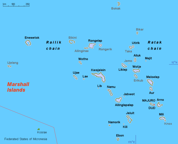
English: Map (rough) Marshall islands, own work composed from various mapreferences
|
| Date | 3 March 2008 |
| Source | Own work |
| Author | Hobe / Holger Behr |
Licensing
 |
I, the copyright holder of this work, release this work into the public domain. This applies worldwide. In some countries this may not be legally possible; if so: I grant anyone the right to use this work for any purpose, without any conditions, unless such conditions are required by law.
|
File usage
The following pages on Schools Wikipedia link to this image (list may be incomplete):
Wikipedia for Schools...
Schools Wikipedia was created by children's charity SOS Childrens Villages. SOS Childrens Villages helps more than 2 million people across 133 countries around the world. Find out how you can help children in other countries.