 |
This is a file from the Wikimedia Commons. Information from its description page there is shown below.
Commons is a freely licensed media file repository. You can help.
|
| Description |
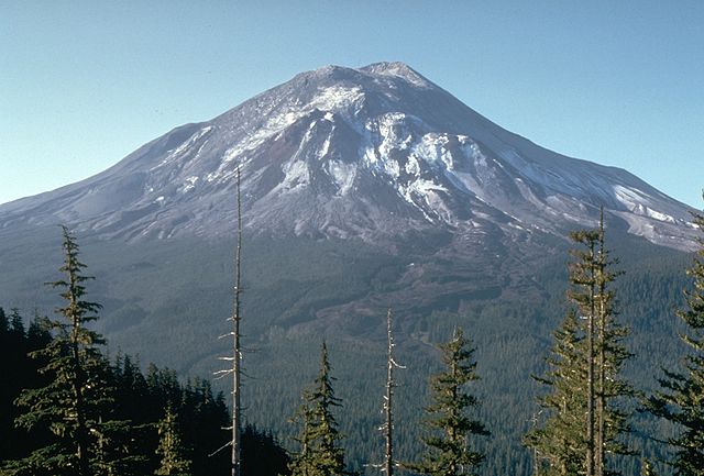
This slide shows Mount St. Helens, one day before the devastating eruption. The view is from Johnston Ridge, six miles (10 kilometers) northwest of the volcano. Italiano: Monte Sant'Elena il giorno prima dell'eruzione del 1980
Slovenčina: Sopka St. Helens pre erupciou v roku 1980.
|
| Date |
17 May 1980 |
| Source |
USGS photo of Mt. Saint Helens |
| Author |
Harry Glicken, USGS/CVO |
Permission
( Reusing this file) |
| Public domainPublic domainfalsefalse |
 |
This image is in the public domain because it contains materials that originally came from the United States Geological Survey, an agency of the United States Department of the Interior. For more information, see the official USGS copyright policy.
български | català | Deutsch | English | español | eesti | suomi | français | galego | italiano | 한국어 | македонски | മലയാളം | Nederlands | polski | português | русский | Türkçe | 中文 | 中文(简体) | +/−
|
|
|
File usage
The following pages on Schools Wikipedia link to this image (list may be incomplete):
Schools Wikipedia was created by children's charity SOS Children. SOS Children's Villages believes that a decent childhood is essential to a happy, healthy. Our community work brings families new opportunities through education, healthcare and all manner of support. Would you like to sponsor a child?


