
File:Solomon Islands 1989.jpg
Size of this preview: 600 × 480 pixels.
| |
This is a file from the Wikimedia Commons. Information from its description page there is shown below.
Commons is a freely licensed media file repository. You can help. |
Summary
| Description |
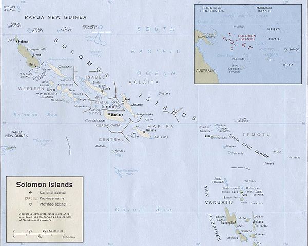
English: Map of the Solomon Islands as of 1989. Province names are included, except for two new provinces as of 1995: the Rennell and Bellona Province (formerly part of Central Province) and the Choiseul Province (formerly part of Western Province).
|
| Date | 1989 |
| Source | Solomon Islands (Political) 1989 from Perry-Castañeda Library Map Collection: Solomon Islands Maps. Cropped to remove white space from edges of map. |
| Author | U.S. Central Intelligence Agency |
| Permission ( Reusing this file) |
Public domain |
| |
This image is a copy or a derivative work of solomon_islands_pol89.jpg, from the map collection of the Perry-Castañeda Library (PCL) of the University of Texas at Austin. This tag does not indicate the copyright status of the attached work. A normal copyright tag is still required. See Commons:Licensing for more information. |
Licensing
 |
This image is a work of a Central Intelligence Agency employee, taken or made as part of that person's official duties. As a Work of the United States Government, this image or media is in the public domain.
|
 |
File usage
The following pages on Schools Wikipedia link to this image (list may be incomplete):
About Schools Wikipedia
SOS Childrens Villages has brought Wikipedia to the classroom. SOS Childrens Villages helps those who have nothing and no one, giving them back the famly they have lost and bringing them the very best opportunities for a happy, healthy future. There are many ways to help with SOS Children's Villages.