
File:Bhutan protected areas location map.png
Size of this preview: 640 × 418 pixels.
| |
This is a file from the Wikimedia Commons. Information from its description page there is shown below.
Commons is a freely licensed media file repository. You can help. |
Summary
| Description |
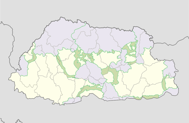
English: Location map of Bhutan with protected areas and corridors shaded.
Equirectangular projection, N/S stretching 115 %. Geographic limits of the map:
|
| Date | 24 July 2011 |
| Source | map from File:Bhutan location map.svg; information from Bhutan Trust Fund – Parks of Bhutan |
| Author | User:NordNordWest; Bhutan Trust Fund, Government of Bhuan |
Licensing
| This file is licensed under the Creative Commons Attribution-Share Alike 3.0 Unported license. | ||
|
File usage
The following pages on Schools Wikipedia link to this image (list may be incomplete):
About Schools Wikipedia
Schools Wikipedia was created by children's charity SOS Childrens Villages. SOS Children helps those who have nothing and no one, giving them back the famly they have lost and bringing them the very best opportunities for a happy, healthy future. Sponsoring a child is the coolest way to help.