
File:British Empire 1921 IndianSubcontinent.png
Size of this preview: 640 × 281 pixels.
| |
This is a file from the Wikimedia Commons. Information from its description page there is shown below.
Commons is a freely licensed media file repository. You can help. |
Summary
| Description |
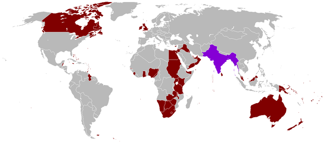
English: A map of the British Empire in 1921 when it was at its height with British Raj indicated when it too was at its height as well.
|
||
| Date | Uploaded on 27 August 2008, 21:41. | ||
| Source | Own work. | ||
| Author | Vadac. | ||
| Permission ( Reusing this file) |
|

 |
This map image could be recreated using vector graphics as an SVG file. This has several advantages; see Commons:Media for cleanup for more information. If an SVG form of this image is already available, please upload it. After uploading an SVG, replace this template with {{ vector version available|new image name.svg}}. |
File usage
The following pages on Schools Wikipedia link to this image (list may be incomplete):
Schools Wikipedia and SOS Children
Wikipedia for Schools is one of SOS Childrens Villages' many educational projects. In 133 nations around the world, SOS Children works to bring better education and healthcare to families in desperate need of support. Go to http://www.soschildrensvillages.org.uk/sponsor-a-child to sponsor a child.