 |
This is a file from the Wikimedia Commons. Information from its description page there is shown below.
Commons is a freely licensed media file repository. You can help.
|
Summary
| Description |
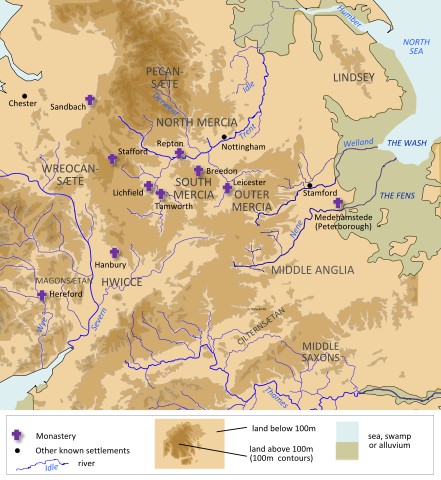
English: A map of Mercia, made using information from OpenStreetMap, Hill 'An Atlas of Anglo-Saxon England' and Stenton, 'Anglo-Saxon England'
|
| Date |
15 July 2012 |
| Source |
Own work |
| Author |
Hel-hama |
Licensing
|
I, the copyright holder of this work, hereby publish it under the following license:
|
File usage
The following pages on Schools Wikipedia link to this image (list may be incomplete):
This file contains additional information, probably added from the digital camera or scanner used to create or digitize it. If the file has been modified from its original state, some details may not fully reflect the modified file.
SOS Children chose the best bits of Wikipedia to help you learn. Thanks to SOS Childrens Villages, 62,000 children are enjoying a happy childhood, with a healthy, prosperous future ahead of them. Would you like to sponsor a child?


