 |
This is a file from the Wikimedia Commons. Information from its description page there is shown below.
Commons is a freely licensed media file repository. You can help.
|
Summary
| Description |
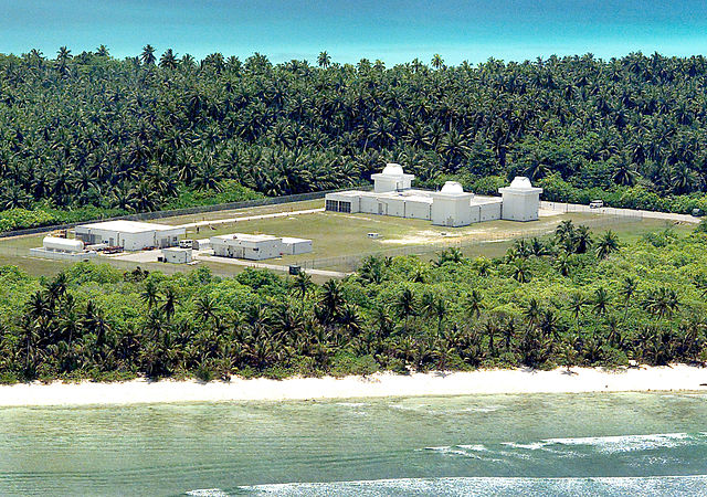
English: The Ground-Based Electro-Optical Deep Space Surveillance System (GEODSS) facility in Southwest Asia is one of three operational sites worldwide. Specialists at the three sites track known man-made deep space objects in orbit around earth. (U.S. Air Force photo/Senior Master Sgt. John Rohrer)
|
| Date |
1 May 2006 |
| Source |
 |
This Image was released by the United States Air Force with the ID 060501-F-0000S-003 (next).
This tag does not indicate the copyright status of the attached work. A normal copyright tag is still required. See Commons:Licensing for more information.
|
 |
http://www.af.mil/shared/media/photodb/photos/060501-F-0000S-003.jpg |
| Author |
U.S. Air Force photo/Senior Master Sgt. John Rohrer |
Licensing
| Public domainPublic domainfalsefalse |
 |
This image or file is a work of a U.S. Air Force Airman or employee, taken or made as part of that person's official duties. As a work of the U.S. federal government, the image or file is in the public domain.
|
|
File usage
The following pages on Schools Wikipedia link to this image (list may be incomplete):
This file contains additional information, probably added from the digital camera or scanner used to create or digitize it. If the file has been modified from its original state, some details may not fully reflect the modified file.


