
File:Amazon rainforest.jpg
Amazon_rainforest.jpg (400 × 329 pixels, file size: 78 KB, MIME type: image/jpeg)
| |
This is a file from the Wikimedia Commons. Information from its description page there is shown below.
Commons is a freely licensed media file repository. You can help. |
Summary
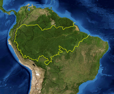
| Description | This is a map location of the Amazon Basin. The yellow line encloses Amazon Basin as delineated by the World Wide Fund for Nature. National boundaries are shown in black. I, Pfly, made it using NASA Blue Marble imagery and ecoregion GIS data which I simplified and digitized in Photoshop. | |||||
| Date | 24 January 2007 | |||||
| Source | NASA, plus my additions by myself. | |||||
| Author | Pfly | |||||
| Permission ( Reusing this file) |
|


File usage
The following pages on Schools Wikipedia link to this image (list may be incomplete):
Metadata
A background to Schools Wikipedia
SOS Children's Villages aims to make Wikipedia suitable for young learners. SOS Children helps more than 2 million people across 133 countries around the world. Have you thought about sponsoring a child?