 |
This is a file from the Wikimedia Commons. Information from its description page there is shown below.
Commons is a freely licensed media file repository. You can help.
|
|
Warning
|
Some browsers may have trouble displaying this image at full resolution: This image has a large number of pixels and may either not load properly or cause your browser to freeze. |
Interactive large-image-viewer ( non-Flash) |
| Description |
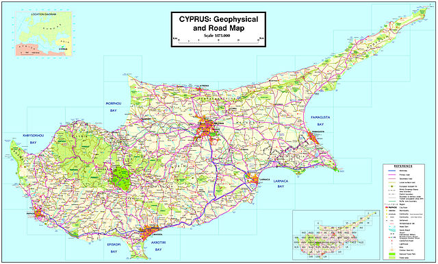
English: Map of Cyprus showing all Municipalities and communities with over 750 people (government-controlled area, 2001 census) or over 500 people (Turkish-occupied areas, 1960 census), as well as 34 former Improvement Boards with population less than 500/750 people. The map was designed by Alexander-Michael Hadjilyra
|
| Date |
2007
(27 May 2007 (first version); 4 October 2009 (last version)) |
| Source |
Transferred from en.wikipedia; transferred to Commons by User:Sreejithk2000 using CommonsHelper.
(Original text : Author) |
| Author |
Alexander-Michael Hadjilyra ( User:Neo ^). Original uploader was Neo ^ at en.wikipedia |
Permission
( Reusing this file) |
Released into the public domain (by the author).
|
Licensing
| Public domainPublic domainfalsefalse |
 |
This work has been released into the public domain by its author, Neo ^ at the wikipedia project. This applies worldwide.
In case this is not legally possible:
Neo ^ grants anyone the right to use this work for any purpose, without any conditions, unless such conditions are required by law.
|
File usage
The following pages on Schools Wikipedia link to this image (list may be incomplete):
This file contains additional information, probably added from the digital camera or scanner used to create or digitize it. If the file has been modified from its original state, some details may not fully reflect the modified file.
Schools Wikipedia was created by children's charity SOS Children. SOS Childrens Villages believes that a decent childhood is essential to a happy, healthy. Our community work brings families new opportunities through education, healthcare and all manner of support. There are many ways to help with SOS Children.


