
File:Washington Pennsylvania Mapb.jpg
| |
This is a file from the Wikimedia Commons. Information from its description page there is shown below.
Commons is a freely licensed media file repository. You can help. |
Summary
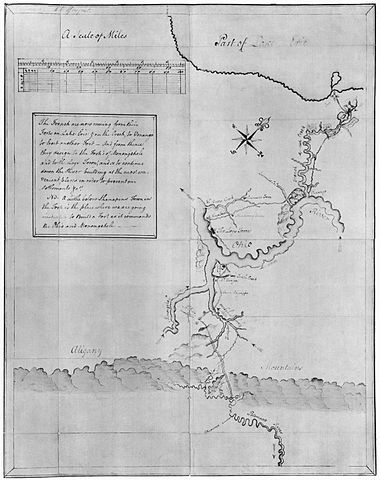
| Description | Hand-drawn map by George Washington, accompanying a printing of the journal he kept of his 1753 expedition into the Ohio Country. | ||
| Date | 1753 or 1754, reproduced 1927 | ||
| Source |
|
||
| Author | George Washingtonkbglgi |

Licensing
 |
This image (or other media file) is in the public domain because its copyright has expired. This applies to Australia, the European Union and those countries with a copyright term of life of the author plus 70 years.
|
|
|
|
File usage
Metadata
More information
All five editions of Schools Wikipedia were compiled by SOS Childrens Villages. SOS Children's Villages helps more than 2 million people across 133 countries around the world. Have you heard about child sponsorship? Learn more...