 |
This is a file from the Wikimedia Commons. Information from its description page there is shown below.
Commons is a freely licensed media file repository. You can help.
|
Summary
| DescriptionFaroe Islands, Eysturoy, road from Skipanes to Syđrugøta.jpg |
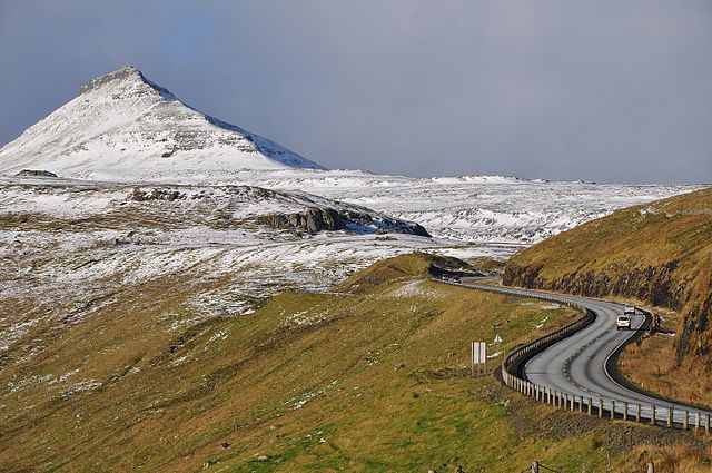
English: The road network on the Faroe Islands is excellent, considering the small numer of people living there. Six of the main islands are connected by tunnels, bridges and dams. Shown is the road from Skipanes to Syđrugøta on the island Eysturoy.
Nederlands: Het wegennet op de Faeroer eilanden is uitstekend. Zes eilanden zijn onderling verbonden met tunnels, bruggen en dammen, en ook op de eilanden zelf zijn lange tunnels gegraven voor het bereikbaar maken van piepkleine dorpen. Op de foto de weg van Skipanes naar Syđrugøta op het eiland Eysturoy.
|
| Date |
22 October 2010 |
| Source |
Own work |
| Author |
Vincent van Zeijst |
•
|
Camera location
|
62° 10′ 35.66″ N, 6° 46′ 2.74″ W
|
View this and other nearby images on: Google Maps - Google Earth - OpenStreetMap |
( Info)62.176572222222;-6.7674277777778 |
Licensing
|
I, the copyright holder of this work, hereby publish it under the following license:
|
File usage
The following pages on Schools Wikipedia link to this image (list may be incomplete):
This file contains additional information, probably added from the digital camera or scanner used to create or digitize it. If the file has been modified from its original state, some details may not fully reflect the modified file.


