
File:Deutschland Lage von Hamburg.svg
Size of this preview: 354 × 479 pixels.
| |
This is a file from the Wikimedia Commons. Information from its description page there is shown below.
Commons is a freely licensed media file repository. You can help. |
Clickable version

| Description |
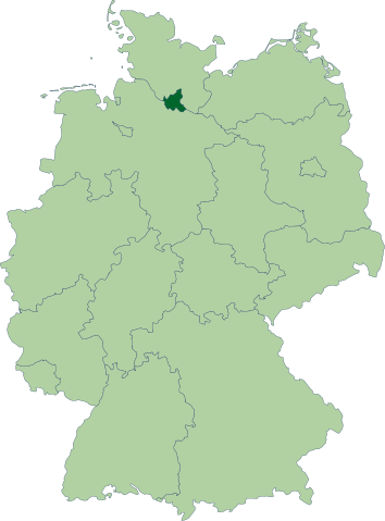
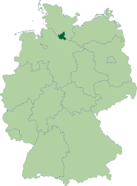
Deutsch: Karte der Bundesrepublik Deutschland mit eingezeichneten Grenzen und alphabetischer Nummerierung der Bundesländer. Hamburg ist farblich hervorgehoben.
|
|||||
| Date | 15 October 2006 | |||||
| Source | Erstellt aus Material des gemeinsamen Datenangebotes aus dem gemeinsamen Portal der statistischen Ämter des Bundes und der Länder (DeStatis). | |||||
| Author | David Liuzzo | |||||
| Permission ( Reusing this file) |
|

File usage
The following pages on Schools Wikipedia link to this image (list may be incomplete):
Metadata
A background to Schools Wikipedia
Schools Wikipedia was created by children's charity SOS Children's Villages. SOS Children's Villages is an international children's charity, providing a good home and loving family to thousands of children who have lost their parents. We also work with communities to help vulnerable families stay together and raise children in the best possible environment. Would you like to sponsor a child?