 |
This is a file from the Wikimedia Commons. Information from its description page there is shown below.
Commons is a freely licensed media file repository. You can help.
|
Summary
| DescriptionUS Secession map 1863 (BlankMap derived).png |
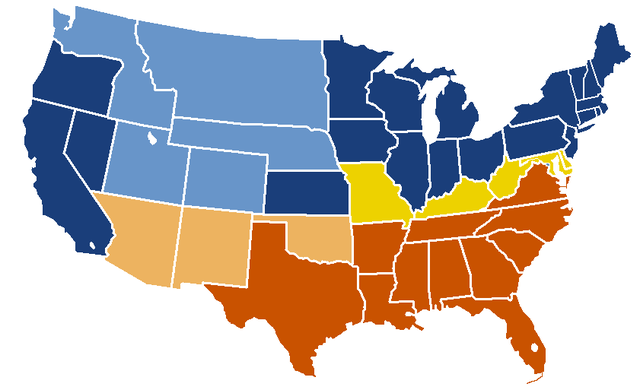
English: United States map of 1863, show affiliation of states and territories regarding the Secession War (Civil War.) Legend: Union states
Union territories not permitting slavery
Border Union states, permitting slavery
Confederate states
Union territories permitting slavery
|
| Date |
original upload date: 19:04, 24 February 2007 |
| Source |
- Map: Image:BlankMap-USA-states.PNG
- Information: Image:US_Secession_map_1865.svg
|
| Author |
w:en:Porsche997SBS ( talk | contribs) |
Licensing
| Public domainPublic domainfalsefalse |
 |
This map was obtained from an edition of the National Atlas of the United States. Like almost all works of the U.S. federal government, works from the National Atlas are in the public domain.
Online access: NationalAtlas.gov | 1970 print edition: Library of Congress, Perry-Castañeda Library
|
|
File usage
The following pages on Schools Wikipedia link to this image (list may be incomplete):


