 |
This is a file from the Wikimedia Commons. Information from its description page there is shown below.
Commons is a freely licensed media file repository. You can help.
|
Summary
| Description |
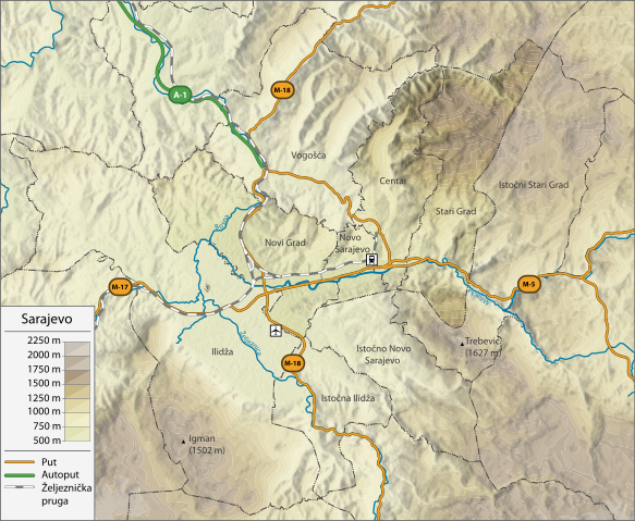
English: Topographic map of Sarajevo
|
| Date |
21 December 2012, 16:01:47 |
| Source |
Own work Sources :
- Topographic background : NASA Shuttle Radar Topography Mission (public domain). SRTM3 v.2 for altitude levels.
- Rivers, borders, roads : Data from © OpenStreetMap contributors, made available under the terms of the Open Database License (ODbL).
- Airport and train station sign: File:Maps template-fr.svg by User:Sting
Software used :
- NASA data edited with 3DEM
- Vectorized with Adobe Illustrator CS5
|
| Author |
DzWiki |
Licensing
|
I, the copyright holder of this work, hereby publish it under the following license:
|
File usage
The following pages on Schools Wikipedia link to this image (list may be incomplete):
This file contains additional information, probably added from the digital camera or scanner used to create or digitize it. If the file has been modified from its original state, some details may not fully reflect the modified file.
Schools Wikipedia was created by children's charity SOS Childrens Villages. SOS Childrens Villages cares for children who have lost their parents. Our Children's Villages give these children a new home and a new family, while a high-quality education and the best of medical care ensures they will grow up with all they need to succeed in adult life. Would you like to sponsor a child?


