
File:Gaborone Road Map.png
Size of this preview: 640 × 379 pixels.
| |
This is a file from the Wikimedia Commons. Information from its description page there is shown below.
Commons is a freely licensed media file repository. You can help. |
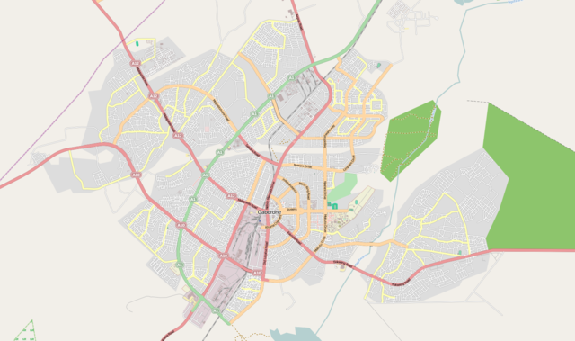
| Description | This map was created from OpenStreetMap project data, collected by the community. This map may be incomplete, and may contain errors. Don't rely solely on it for navigation. | |||||
| Date | (see file history) | |||||
| Source | See the image in its original context on the OpenStreetMap wiki page for Gaborone | |||||
| Author | OpenStreetMap contributors | |||||
| Permission ( Reusing this file) |
OpenStreetMap data and maps are licensed under the Creative Commons Attribution-ShareAlike 2.0 license (CC-BY-SA 2.0).
|
File usage
The following pages on Schools Wikipedia link to this image (list may be incomplete):
Want to know more?
Schools Wikipedia was created by children's charity SOS Children's Villages. SOS Children works in 133 countries and territories across the globe, helps more than 62,000 children, and reaches over 2 million people in total. Want to learn more? Go to http://www.soschildrensvillages.org.uk/sponsor-a-child