
File:Bản đồ Hà Nội.png
Size of this preview: 480 × 479 pixels.
| |
This is a file from the Wikimedia Commons. Information from its description page there is shown below.
Commons is a freely licensed media file repository. You can help. |
| Description |
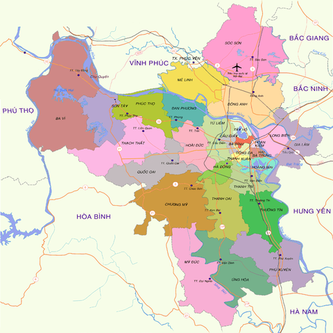
English: Map of Hanoi at the end of 2008
Tiếng Việt: Bản đồ Hà Nội cuối năm 2008
|
|||||
| Date | 15:19, ngày 30 tháng 12 năm 2008 (UTC) | |||||
| Source | vi:Tập tin:Bản đồ Hà Nội.png | |||||
| Author | Lưu Ly | |||||
| Permission ( Reusing this file) |
|
| Annotations | This image is annotated: View the annotations at Commons |
|
Camera location |
|
View this and other nearby images on: Google Maps - Google Earth - OpenStreetMap | ( Info) |
|---|
| Annotations | This image is annotated: View the annotations at Commons |
File usage
The following pages on Schools Wikipedia link to this image (list may be incomplete):
Metadata
Schools Wikipedia and SOS Children
SOS Children aims to make Wikipedia suitable for young learners. SOS Childrens Villages cares for children who have lost their parents. Our Children's Villages give these children a new home and a new family, while a high-quality education and the best of medical care ensures they will grow up with all they need to succeed in adult life. There are many ways to help with SOS Children.