 |
This is a file from the Wikimedia Commons. Information from its description page there is shown below.
Commons is a freely licensed media file repository. You can help.
|
| Description |
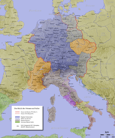
English: Map of the Holy Roman Empire in the 10th century
|
| Date |
|
| Source |
|
| Author |
This file is lacking author information.
|
Permission
( Reusing this file) |
 |
Permission is granted to copy, distribute and/or modify this document under the terms of the GNU Free Documentation License, Version 1.2 or any later version published by the Free Software Foundation; with no Invariant Sections, no Front-Cover Texts, and no Back-Cover Texts. A copy of the license is included in the section entitled GNU Free Documentation License. http://www.gnu.org/copyleft/fdl.htmlGFDLGNU Free Documentation Licensetruetrue
|
|
 |
This image was uploaded in the PNG, GIF, or other lossless image format. However, it contains visible lossy compression artifacts. These artifacts may have come from the JPEG format or from saving a colorful image in the GIF format instead of the PNG format. If possible, please upload a PNG or SVG version of this image, derived from a non-lossy source so that it doesn't contain any compression artifacts (or with existing artifacts removed). After doing so, please replace all instances of the artifacted version throughout Wikimedia projects, tag the old version with one of these templates, and remove this tag. For more information, see Commons:Preparing images for upload and Commons:Media for cleanup.
|
Licensing
File usage
The following pages on Schools Wikipedia link to this image (list may be incomplete):
SOS Children's Villages has brought Wikipedia to the classroom. By supporting vulnerable children right through to adulthood, SOS Childrens Villages makes a lasting difference to the lives of thousands of people. Education is a key part of our work, and our schools provide high-quality teaching to the children in our care. There are many ways to help with SOS Children.


