Checked content

File:Nicobar Islands.jpg
Summary

Description
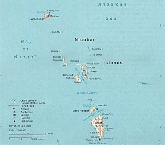
Deutsch: Karte der Inselgruppe der Nikobaren im Indischen Ozean
English: Map of the Nicobar Island in the Indian Ocean
Français : Carte d’îles Nicobar dans l’océan Indien
Date 1976
Source http://www.lib.utexas.edu/maps/islands_oceans_poles/andaman_nicobar_76.jpg
Author Taken from Perry-Castañeda Library (PCL), originally from CIA Indian Ocean Atlas

Licensing

Public domain This image is a work of a Central Intelligence Agency employee, taken or made as part of that person's official duties. As a Work of the United States Government, this image or media is in the public domain.

CIA.svg
The following pages on Schools Wikipedia link to this image (list may be incomplete):

About Schools Wikipedia

All five editions of Schools Wikipedia were compiled by SOS Childrens Villages. The world's largest orphan charity, SOS Childrens Villages brings a better life to more than 2 million people in 133 countries around the globe. Go to http://www.soschildrensvillages.org.uk/sponsor-a-child to sponsor a child.