
File:Leeds in West Yorkshire.jpg
Size of this preview: 640 × 446 pixels.
| |
This is a file from the Wikimedia Commons. Information from its description page there is shown below.
Commons is a freely licensed media file repository. You can help. |
Summary
| Description |
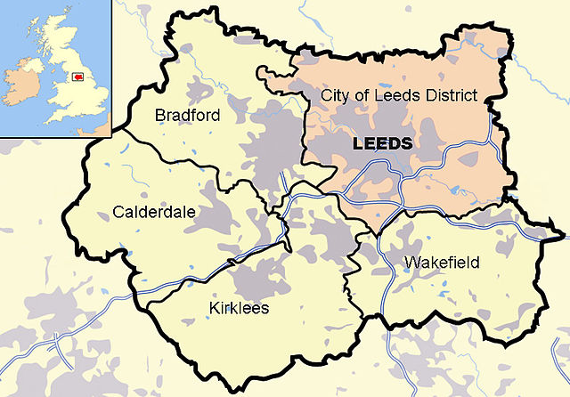
English: Map of en:West Yorkshire and surrounding area, highlighting en:Leeds, with indented map of the British Isles for national context. County and borough boundaries in black, urban areas in grey, motorways in blue with white stripe, water bodies in light blue. Leeds district in pink.
|
| Date | 31 October 2009 |
| Source | Own work based on map by Jhamez84 at en.wikipedia |
| Author | Harkey Lodger based on Jhamez84 at en.wikipedia |
Licensing
 |
I, the copyright holder of this work, release this work into the public domain. This applies worldwide. In some countries this may not be legally possible; if so: I grant anyone the right to use this work for any purpose, without any conditions, unless such conditions are required by law.
|
File usage
The following pages on Schools Wikipedia link to this image (list may be incomplete):
Metadata
Schools Wikipedia facts
SOS Children's Villages has brought Wikipedia to the classroom. SOS Children believes education is an important part of a child's life. That's why we ensure they receive nursery care as well as high-quality primary and secondary education. When they leave school, we support the children in our care as they progress to vocational training or higher education. Would you like to sponsor a child?