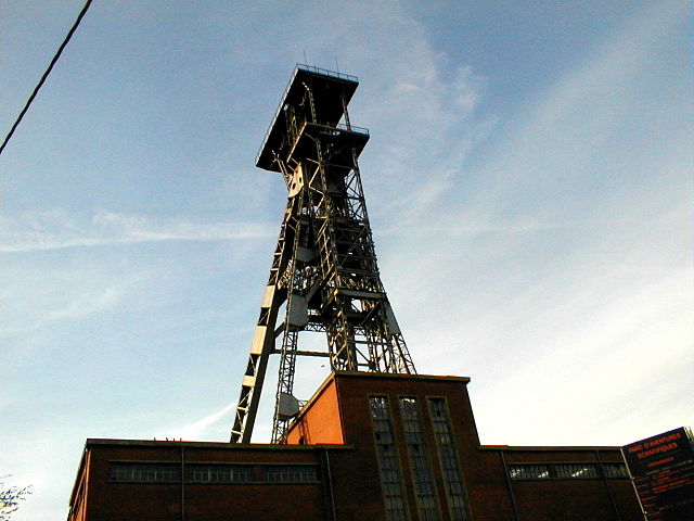
File:Chassis à molette de Crachet à Frameries vue large.JPG

Size of this preview: 640 × 480 pixels.
| |
This is a file from the Wikimedia Commons. Information from its description page there is shown below.
Commons is a freely licensed media file repository. You can help. |
Summary
| Description | Chassis à molette de Crachet à Frameries vue large |
| Date | 13 January 2007 |
| Source | Own work |
| Author | Agrillo Mario |
| Permission ( Reusing this file) |
redistribution à l'identique |
|
Camera location |
50° 24′ 59.39″ N, 3° 54′ 7.17″ E |
This and other images at their locations on: Google Maps - Google Earth - OpenStreetMap | ( Info)50.41649803;3.90199184 |
|---|
Licensing
|
File usage
The following pages on Schools Wikipedia link to this image (list may be incomplete):
Metadata
This file contains additional information, probably added from the digital camera or scanner used to create or digitize it. If the file has been modified from its original state, some details may not fully reflect the modified file.
| Image title |
|
|---|---|
| Camera manufacturer | OLYMPUS OPTICAL CO.,LTD |
| Camera model | C830L,D340R |
| ISO speed rating | 100 |
| Date and time of data generation | 17:10, 29 October 1999 |
| Lens focal length | 5.5 mm |
| Latitude | 50° 24′ 59.39″ N |
| Longitude | 3° 54′ 7.17″ E |
| Author | Chassis à molette de Crachet à Frameries vue large, Agrillo Mario |
| Copyright holder | (C) Agrillo Mario 2009 |
| Orientation | Normal |
| Horizontal resolution | 72 dpi |
| Vertical resolution | 72 dpi |
| Software used | v85p-70 |
| File change date and time | 17:10, 29 October 1999 |
| Y and C positioning | Co-sited |
| Exif version | 2.1 |
| Date and time of digitizing | 17:10, 29 October 1999 |
| Meaning of each component |
|
| Exposure bias | 0 |
| Maximum land aperture | 3 APEX (f/2.83) |
| Metering mode | Average |
| Light source | Unknown |
| Supported Flashpix version | 0,100 |
| Colour space | sRGB |
| File source | Digital still camera |
| GPS time (atomic clock) | 17:10 |
| Satellites used for measurement | 0 |
| Reference for direction of image | True direction |
| Direction of image | 296.85 |
| Geodetic survey data used | WGS-84 |
| Latitude destination | 50° 25′ 0.15″ N |
| Longitude of destination | 3° 54′ 4.82″ E |
| GPS date | 29 October 1999 |
| GPS tag version | 0.0.2.2 |
| Supported Flashpix version | 1 |
| Image height | 1,280 px |
| Image width | 960 px |
| Compression scheme | JPEG (old) |
| Short title | PA290003 |
| Editorial status of image | self|cc-by-sa-all |
| Supplemental categories | Mines |
| City shown | Frameries |
| Sublocation of city shown | Borinage |
| Province or state shown | Hainaut |
| Code for country shown | 032 |
| Country shown | Belgique |
| Credit/Provider | Redistribuer à l'original |
| Source | Photo personnelle |
| Contact information | marioagrillo52@hotmail.com |
| Writer | Agrillo Mario |
Learn more
Wikipedia for Schools was collected by SOS Children's Villages. SOS Childrens Villages is famous for the love and shelter it brings to lone children, but we also support families in the areas around our Children's Villages, helping those who need us the most. Have you heard about child sponsorship? Learn more...
