
File:Palmyra atoll 91.jpg
Size of this preview: 640 × 379 pixels.
| |
This is a file from the Wikimedia Commons. Information from its description page there is shown below.
Commons is a freely licensed media file repository. You can help. |
Summary
| Description |
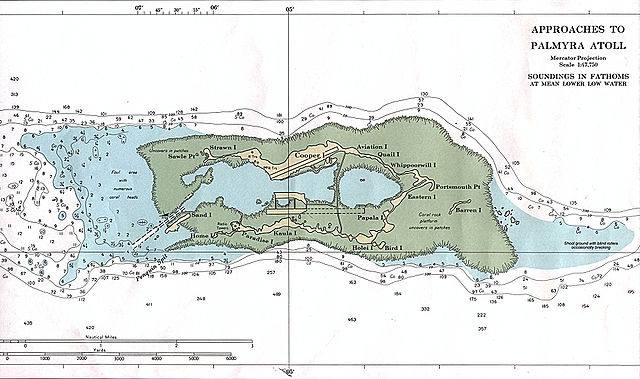
English: NOAA nautical chart of Palmyra Atoll.
|
| Date | |
| Source | http://www.lib.utexas.edu/maps/islands_oceans_poles/palmyra_atoll_91.jpg |
| Author | NOAA |
 |
This map image could be recreated using vector graphics as an SVG file. This has several advantages; see Commons:Media for cleanup for more information. If an SVG form of this image is already available, please upload it. After uploading an SVG, replace this template with {{ vector version available|new image name.svg}}. |
Licensing
 |
This image is in the public domain because it contains materials that originally came from the U.S. National Oceanic and Atmospheric Administration, taken or made as part of an employee's official duties.
|
 |
File usage
The following pages on Schools Wikipedia link to this image (list may be incomplete):
I want to learn more...
Schools Wikipedia has made the best of Wikipedia available to students. SOS Children's Villages helps more than 2 million people across 133 countries around the world. You can help by sponsoring a child.