
File:USSR Ethnic Groups 1974.jpg
Size of this preview: 640 × 449 pixels.
| |
This is a file from the Wikimedia Commons. Information from its description page there is shown below.
Commons is a freely licensed media file repository. You can help. |
 |
This map image could be recreated using vector graphics as an SVG file. This has several advantages; see Commons:Media for cleanup for more information. If an SVG form of this image is already available, please upload it. After uploading an SVG, replace this template with {{ vector version available|new image name.svg}}. |
 |
This map has been uploaded by Electionworld from en.wikipedia.org to enable the |
Summary
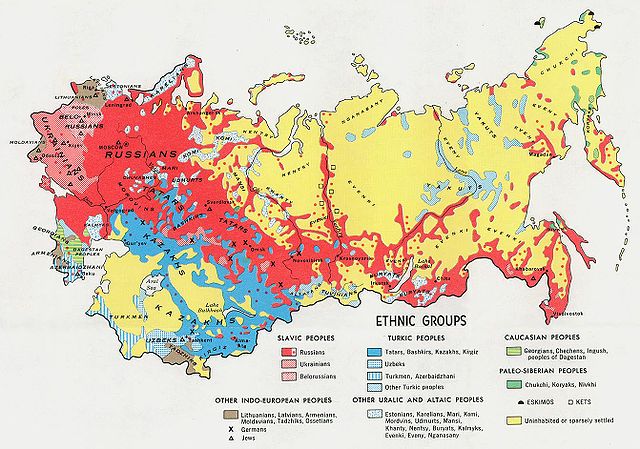
Map displaying the locations of the various ethnic groups comprising the Soviet Union in 1974.
Licensing
| |
This image is a copy or a derivative work of ussr_ethnic_1974.jpg, from the map collection of the Perry-Castañeda Library (PCL) of the University of Texas at Austin. This tag does not indicate the copyright status of the attached work. A normal copyright tag is still required. See Commons:Licensing for more information. |
This map provided courtesy of the University of Texas Libraries, The University of Texas at Austin.
File usage
The following pages on Schools Wikipedia link to this image (list may be incomplete):
Metadata
Learn more about Schools Wikipedia
Schools Wikipedia has made the best of Wikipedia available to students. SOS Childrens Villages helps more than 2 million people across 133 countries around the world. Will you help another child today?