
File:Floyd1999NCLandfall.gif
Size of this preview: 640 × 377 pixels.
| |
This is a file from the Wikimedia Commons. Information from its description page there is shown below.
Commons is a freely licensed media file repository. You can help. |
Summary
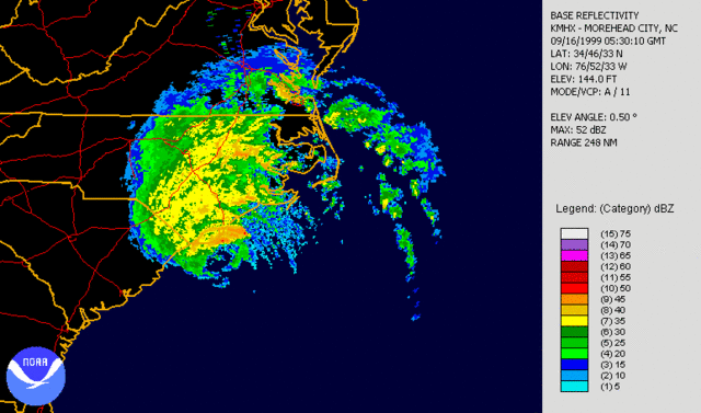
| Description | Hurricane Floyd making landfall in North Carolina on September 16th, 1999. Radar is long range base relectivity. Created using NCDC JAVA NEXRAD tool. |
| Date | 16 September 1999 |
| Source | Source data from NCDC NEXRAD database: http://www.ncdc.noaa.gov/nexradinv/. |
| Author | file created by Hello32020 |
Licensing
 |
This image is in the public domain because it contains materials that originally came from the U.S. National Oceanic and Atmospheric Administration, taken or made as part of an employee's official duties.
|
 |
|
This work is based on a work in the public domain. It has been digitally enhanced and/or modified. This derivative work has been (or is hereby) released into the public domain by its author, Hello32020. This applies worldwide. In some countries this may not be legally possible; if so:
|
File usage
The following pages on Schools Wikipedia link to this image (list may be incomplete):
The best way to learn
All five editions of Schools Wikipedia were compiled by SOS Children. In 133 nations around the world, SOS Children works to bring better education and healthcare to families in desperate need of support. Will you help another child today?