 |
This is a file from the Wikimedia Commons. Information from its description page there is shown below.
Commons is a freely licensed media file repository. You can help.
|
Summary
| DescriptionKilauea - Landsat mosaic.jpg |
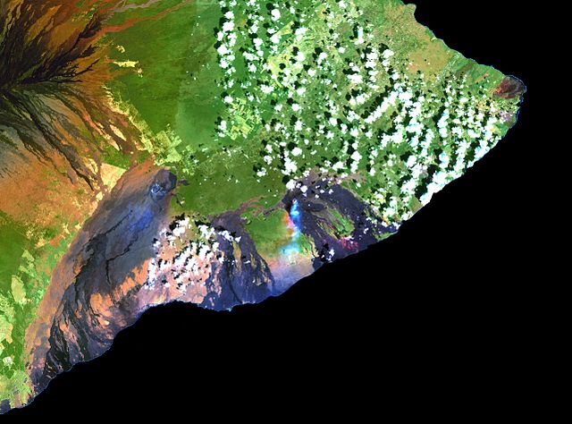
English: This simulated true-colour image of the Kilauea was derived from data gathered by the Enhanced Thematic Mapper plus (ETM+) on the Landsat 7 satellite between 1999 and 2001.
Français : Cette image en fausses couleurs du Kilauea est issue de données recueillies entre 1999 et 2001 par le capteur Enhanced Thematic Mapper plus (ETM+) situé sur le satellite Landsat 7.
|
| Date |
1999-2001 |
| Source |
Cropped version of File:Island of Hawai'i - Landsat mosaic.jpg ( Image and its description) |
| Author |
Hawaii Land Cover Analysis project, NOAA Coastal Services Centre |
Licensing
| Public domainPublic domainfalsefalse |
 |
This image is in the public domain because it contains materials that originally came from the U.S. National Oceanic and Atmospheric Administration, taken or made as part of an employee's official duties.
|
|
File usage
The following pages on Schools Wikipedia link to this image (list may be incomplete):
This file contains additional information, probably added from the digital camera or scanner used to create or digitize it. If the file has been modified from its original state, some details may not fully reflect the modified file.
SOS Childrens Villages has brought Wikipedia to the classroom. SOS Children's Villages cares for children who have lost their parents. Our Children's Villages give these children a new home and a new family, while a high-quality education and the best of medical care ensures they will grow up with all they need to succeed in adult life. There are many ways to help with SOS Children's Villages.


