
File:League of Nations Anachronous Map.png
Size of this preview: 640 × 407 pixels.
| |
This is a file from the Wikimedia Commons. Information from its description page there is shown below.
Commons is a freely licensed media file repository. You can help. |
Summary
| Description |
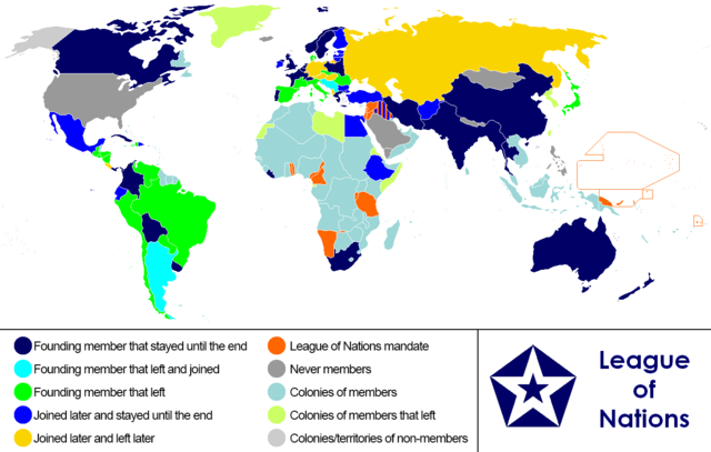
English: Anachronous map of the world between 1920 and 1945 which shows the The League of Nations and the world. (English)
Español: Mapa del mundo entre 1920 y 1945 muestra la posición de la Sociedad de Naciones (inglés)
Français : Carte du monde entre 1920 et 1945 montrant la place de la Société des Nations (anglais
|
| Date | 5 January 2013, 17:30:11 |
| Source | Own work |
| Author | Reallyjoel |
Licensing
|
File usage
The following pages on Schools Wikipedia link to this image (list may be incomplete):
Metadata
Learn more about Schools Wikipedia
Schools Wikipedia was created by children's charity SOS Children. SOS Children's Villages helps more than 2 million people across 133 countries around the world. Help another child by taking out a sponsorship