
File:Awashrivermap.png
Size of this preview: 480 × 479 pixels.
| |
This is a file from the Wikimedia Commons. Information from its description page there is shown below.
Commons is a freely licensed media file repository. You can help. |
Summary
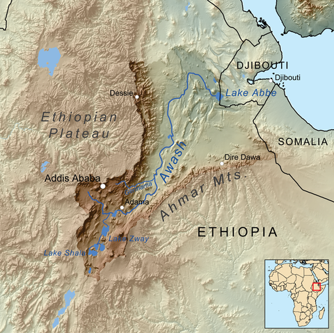
| Description | Map showing the Awash River drainage basin. |
| Date | 6 August 2010 |
| Source | Own work, Elevation data from SRTM, drainage basin from GTOPO , all other features from Vector Map. Rand McNally "New International Atlas" (1993) used as reference. |
| Author | Kmusser |
Licensing
|
File usage
The following pages on Schools Wikipedia link to this image (list may be incomplete):
I want to learn more...
SOS Children's Villages aims to make Wikipedia suitable for young learners. In 133 nations around the world, SOS Children works to bring better education and healthcare to families in desperate need of support. Sponsoring a child is a great way to help children who need your support.