
File:Map of Malta 2.png
Size of this preview: 425 × 480 pixels.
| |
This is a file from the Wikimedia Commons. Information from its description page there is shown below.
Commons is a freely licensed media file repository. You can help. |
 |
This map has been uploaded by Electionworld from en.wikipedia.org to enable the |
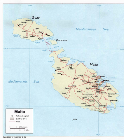
Political map of Malta. Created in 1984 by the Central Intelligence Agency.
 |
This image is in the public domain because it contains materials that originally came from the United States Central Intelligence Agency's World Factbook.
|
 |
 http://www.lib.utexas.edu/maps/europe.html
 http://www.lib.utexas.edu/maps/europe/malta_pol84.jpg
File usage
The following pages on Schools Wikipedia link to this image (list may be incomplete):
Schools Wikipedia and SOS Children
Through Schools Wikipedia, SOS Children has brought learning to children around the world. SOS Childrens Villages cares for children who have lost their parents. Our Children's Villages give these children a new home and a new family, while a high-quality education and the best of medical care ensures they will grow up with all they need to succeed in adult life. Have you thought about sponsoring a child?