
File:Norfolk UK local election results 2011 map.svg
Size of this preview: 640 × 398 pixels.
| |
This is a file from the Wikimedia Commons. Information from its description page there is shown below.
Commons is a freely licensed media file repository. You can help. |
Summary
| Description |
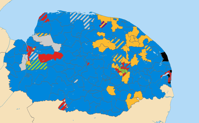
English: Results of all District, Borough and City Council elections held in May 2011.
Colours: Conservative
Liberal Democrat
Labour
Green
Independent (politician)
UKIP
Wards not being contested at these elections Striped wards have mixed representation. |
| Date | 11 December 2012, 22:51:28 |
| Source | Derived from File:Norfolk_UK_electoral_division_map_(blank).svg, created by Nilfanion using Ordnance Survey OpenData. |
| Author | Woodgreener, derived from work by Nilfanion using Ordnance Survey OpenData |
Licensing
| This file is licensed under the Creative Commons Attribution-Share Alike 3.0 Unported license. | ||
| Attribution: Contains Ordnance Survey data © Crown copyright and database right | ||
|
File usage
The following pages on Schools Wikipedia link to this image (list may be incomplete):
Metadata
Did you know...?
SOS Childrens Villages aims to make Wikipedia suitable for young learners. Thanks to SOS Childrens Villages, 62,000 children are enjoying a happy childhood, with a healthy, prosperous future ahead of them. If you'd like to help, learn how to sponsor a child.