
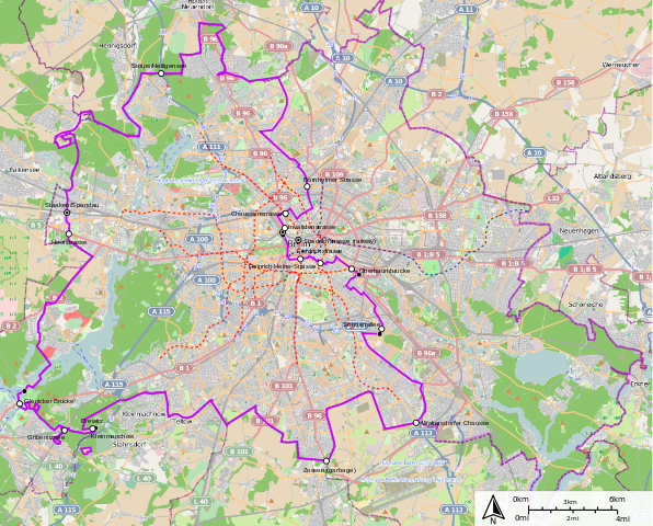
File:West and East Berlin.svg
Size of this preview: 596 × 480 pixels.
| |
This is a file from the Wikimedia Commons. Information from its description page there is shown below.
Commons is a freely licensed media file repository. You can help. |
Contents |
Interactive and editable version (CC license
THIS MAP IS AVAILABLE FOR INTERACTIVE VIEWING ON DESKTOP AND MOBILE DEVICES, YOU CAN FIND INTERACTIVE VERSION [ http://sharemap.org/public/West_and_East_Berlin | HERE
Summary
| Description |
English: West and East Berlin
Legend:
|
| Date | 12 September 2012 |
| Source | http://sharemap.org/public/West_and_East_Berlin Geospatial data sources:
|
| Author | Jkan997 |
Created with ShareMap.org
Thumbnail with colored legend in caption
[[File:West and East Berlin.svg|thumb|
Licensing
|

File usage
The following pages on Schools Wikipedia link to this image (list may be incomplete):
Metadata
Find out about Schools Wikipedia
Wikipedia for Schools is one of SOS Children's Villages' many educational projects. The world's largest orphan charity, SOS Children brings a better life to more than 2 million people in 133 countries around the globe. There are many ways to help with SOS Children.