 |
This is a file from the Wikimedia Commons. Information from its description page there is shown below.
Commons is a freely licensed media file repository. You can help.
|
Summary
| Description |
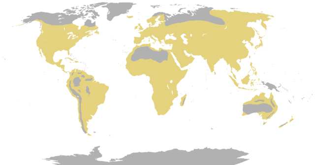
English: Map showing the range of the Cow and allies.
|
| Date |
19 November 2011 (original upload date) |
| Source |
This file was derived from:
|
| Author |
- derivative work: Lguipontes
|
 |
This is a retouched picture, which means that it has been digitally altered from its original version. Modifications: It was quite unreasonable map. Northern South America and Cape Verde without cattle but Baffin Island with it?!. The original can be viewed here: Bovine_range.png. Modifications made by Lguipontes.
|
Licensing
I, the copyright holder of this work, hereby publish it under the following license:
  |
This file is made available under the Creative Commons CC0 1.0 Universal Public Domain Dedication. |
| The person who associated a work with this deed has dedicated the work to the public domain by waiving all of his or her rights to the work worldwide under copyright law, including all related and neighboring rights, to the extent allowed by law. You can copy, modify, distribute and perform the work, even for commercial purposes, all without asking permission. http://creativecommons.org/publicdomain/zero/1.0/deed.enCC0Creative Commons Zero, Public Domain Dedicationfalsefalse
|
|
File usage
The following pages on Schools Wikipedia link to this image (list may be incomplete):
This file contains additional information, probably added from the digital camera or scanner used to create or digitize it. If the file has been modified from its original state, some details may not fully reflect the modified file.


